29°10'52.2"N 102°59’33.6"W, 2019
Five-part series, analogue print of 35mm camera color negative, Fuji Crystal Archival photo paper, 40 x 30 cm each, framed, passe-partout, non-reflecting glass, edition 3 + 1 AP
The five-part work bears the coordinates of the location 29°10‘52.2“N 102°59‘33.6“W as its title. The picture was taken during the longest government shutdown in the US history (35 days), due to President Donald Trump‘s demand for state funding for the construction of a border wall between the US and Mexico.
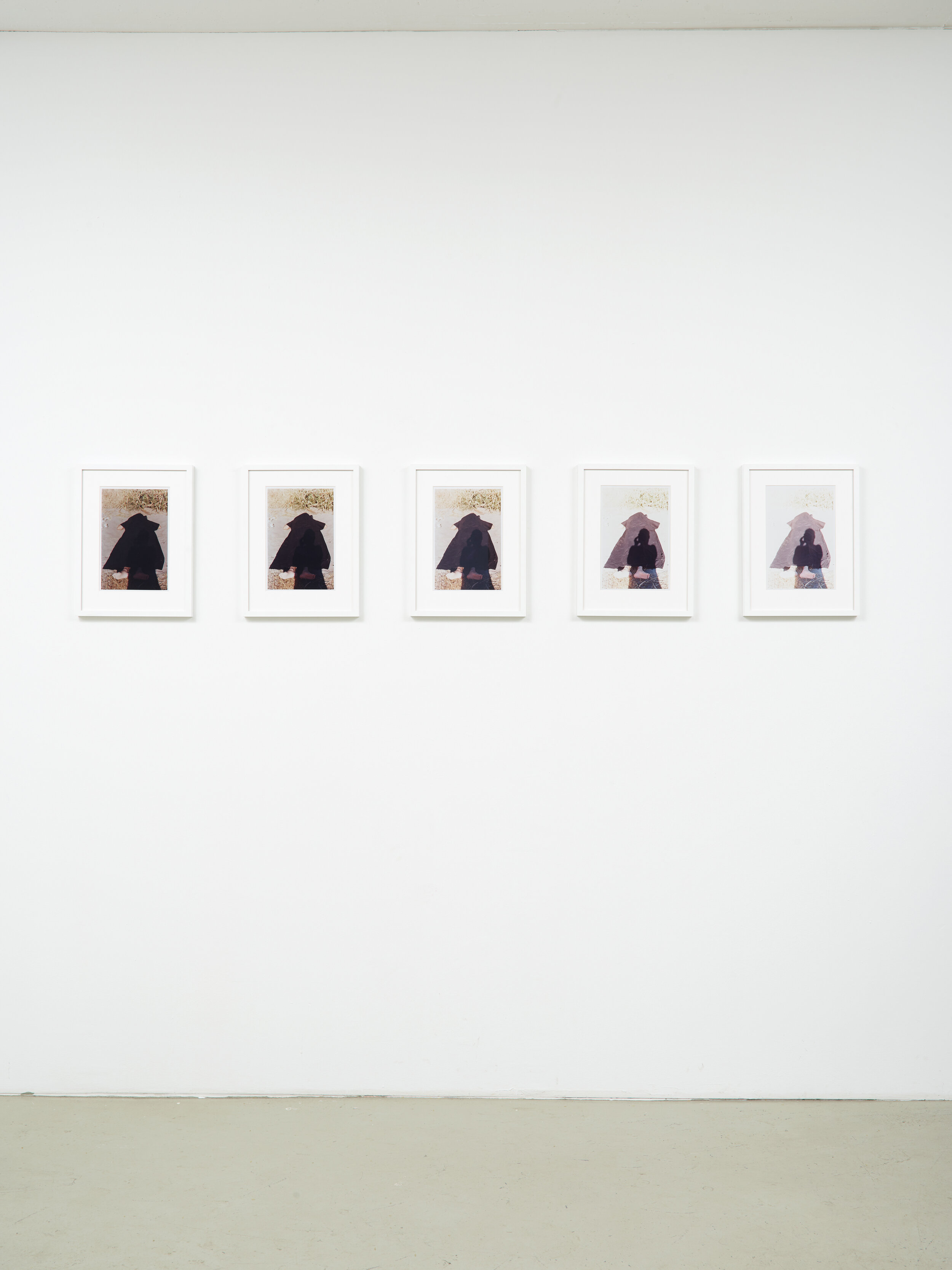
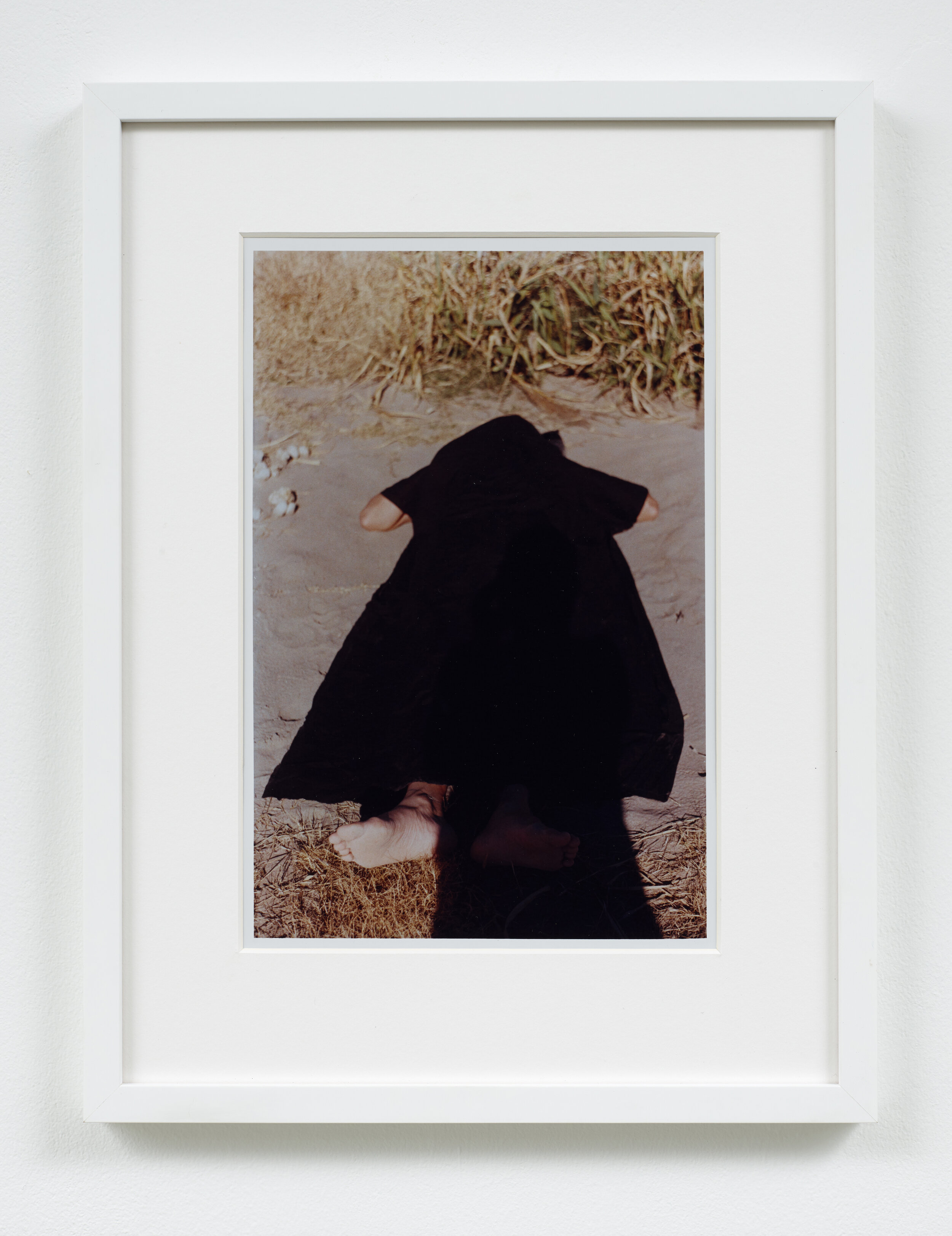
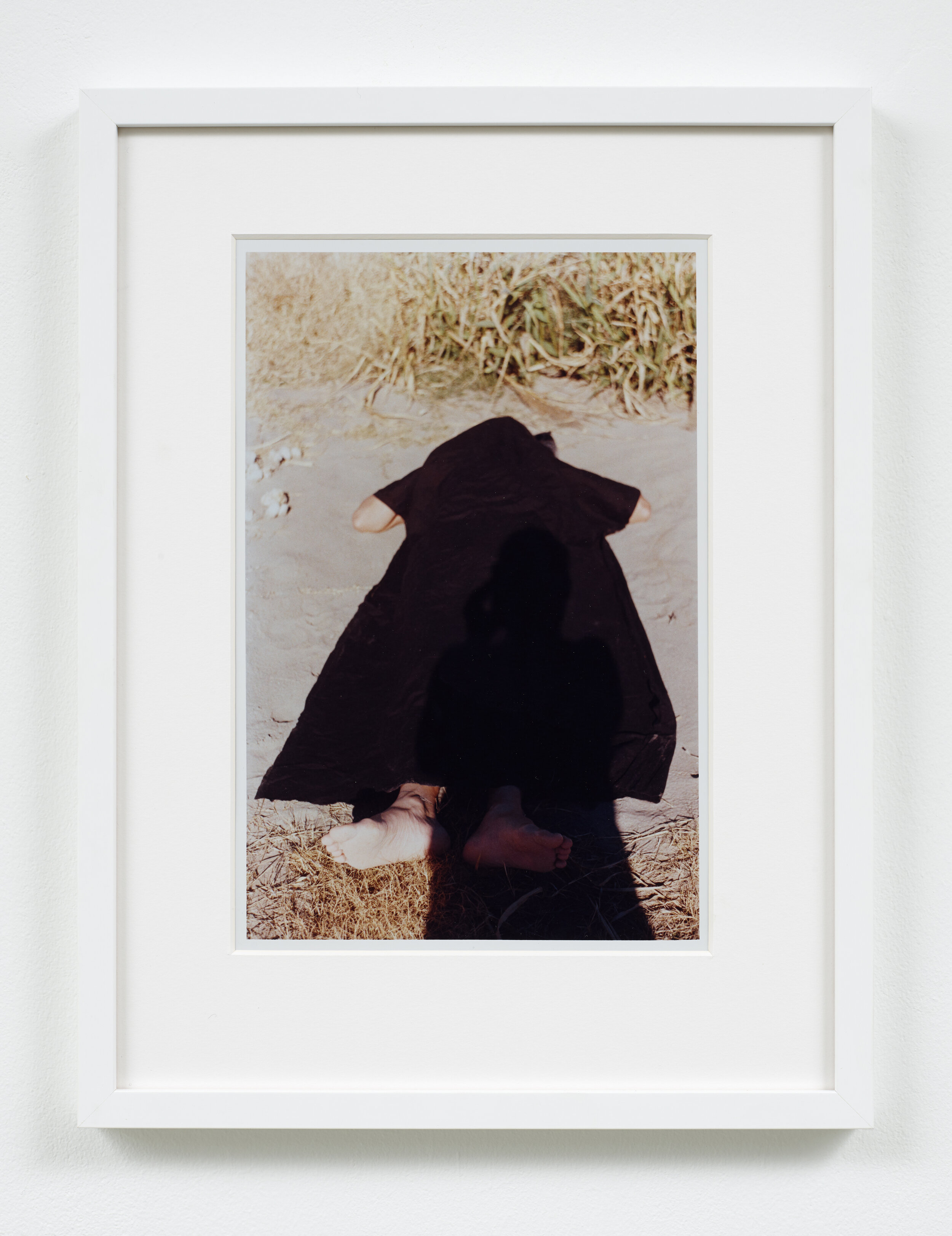
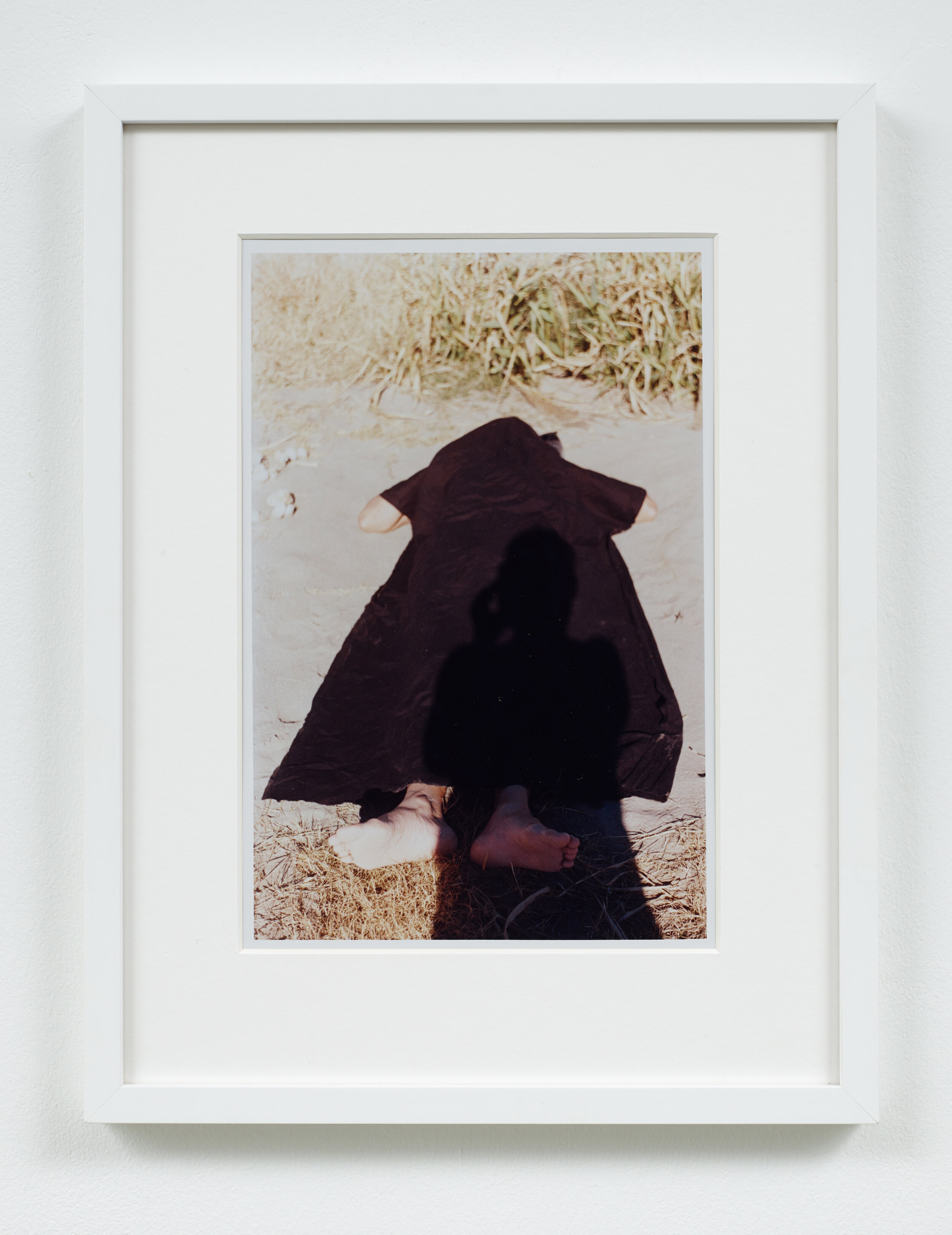
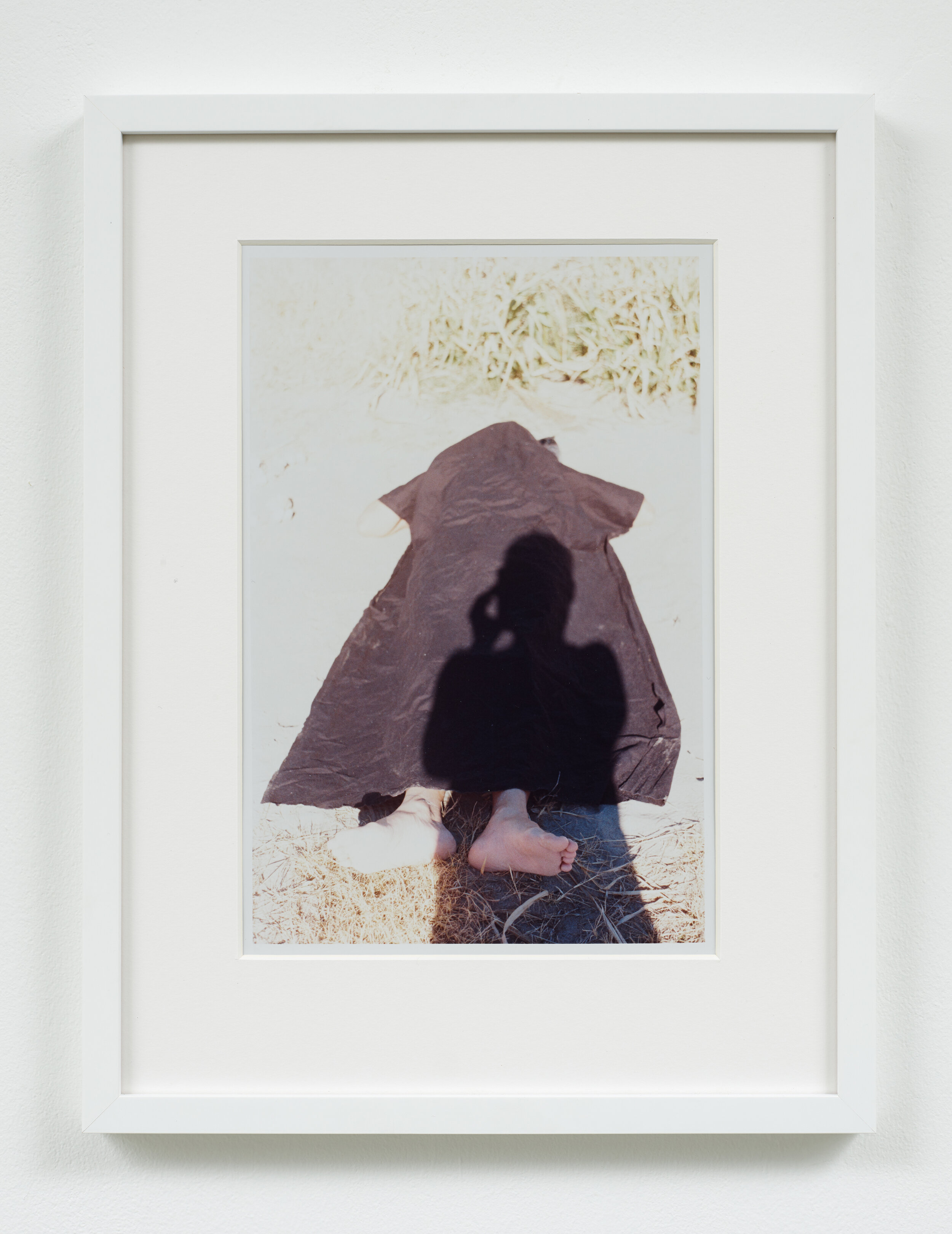
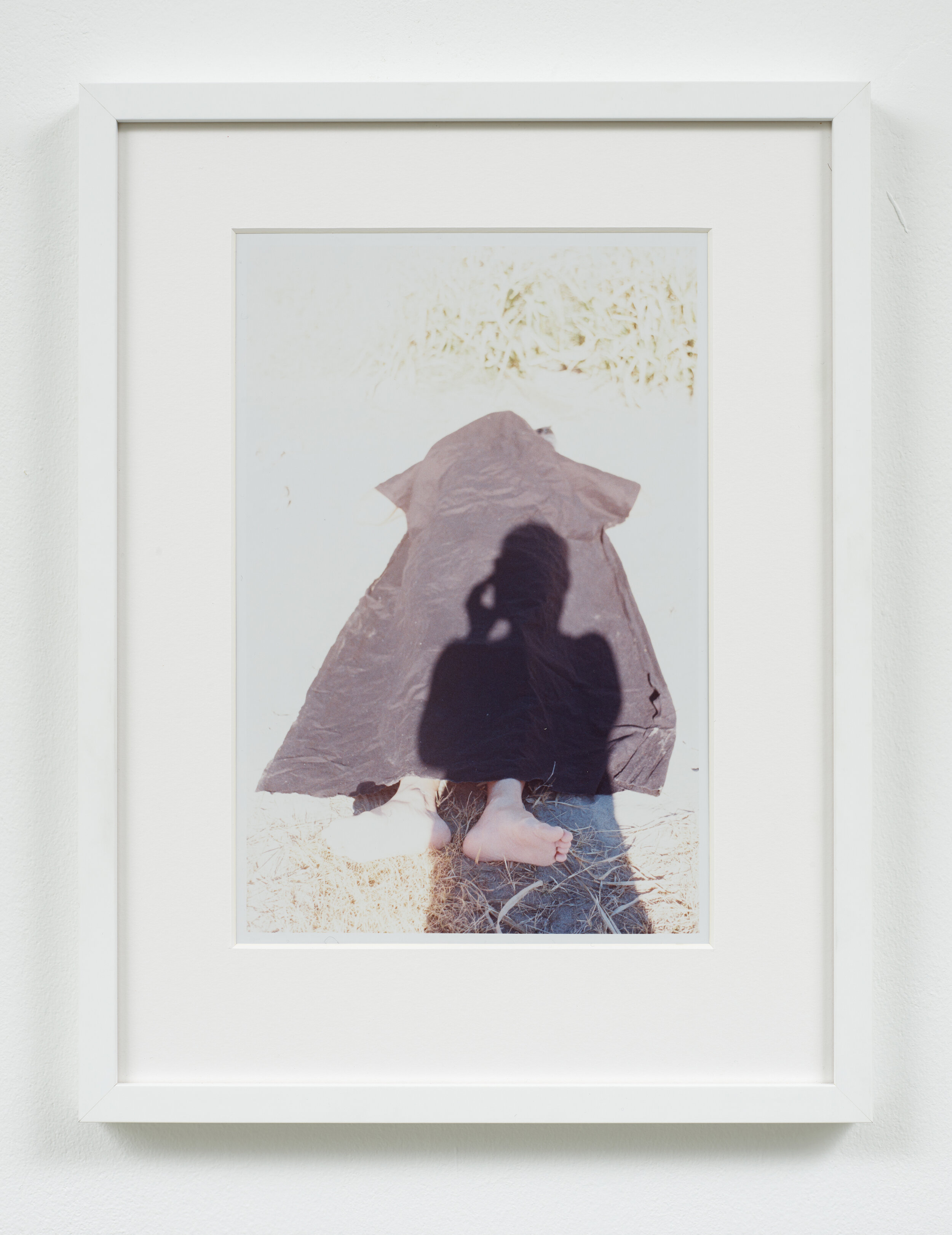
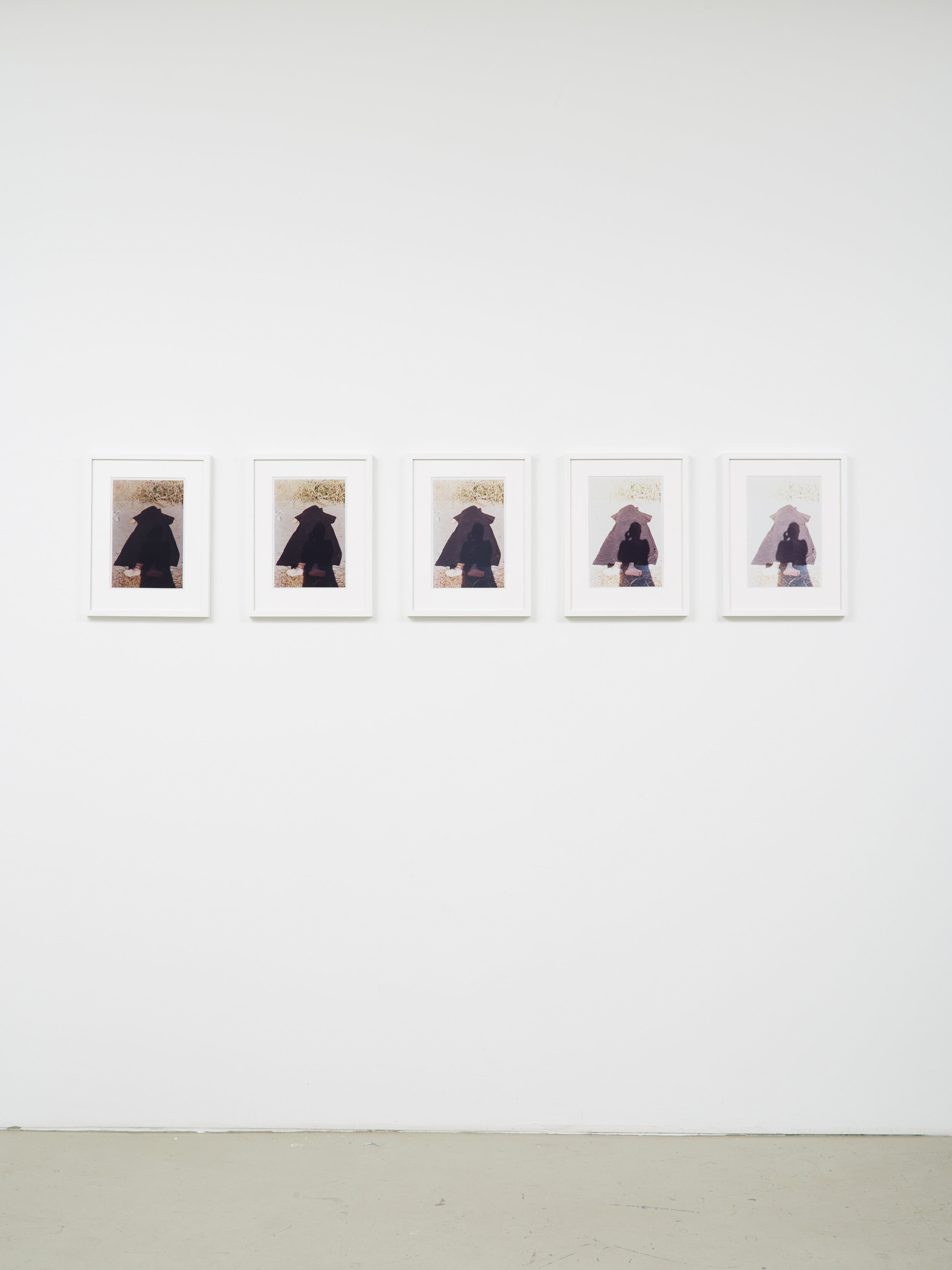
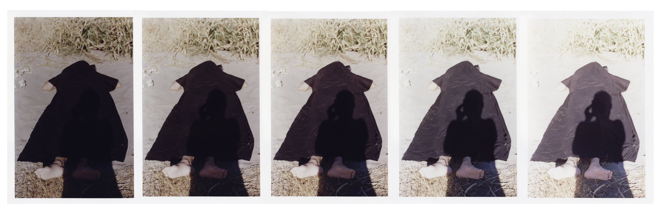
Photo: Simon Vogel